


| Other Sellers | Prices | ShippingCost | |
|---|---|---|---|
| amazon.com | US $2.9 | US $0.9 | buy in amazon |
| us.shein.com | US $0.9 | US $1.9 | buy in shein |
Bestseller
1897 Ontario & Quebec Original Antique Map by A & C Black
ebay.com
diddersgoods100.0% positive rating
US$26.84
Antiques
Maps, Atlases & Globes
North America Maps
shippingCost free
most popular

Erie PA anitique Map 10 Folio Pages Handcolored
$400.00
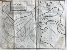
Rare 18thC Map America Plan of Port Royal Carolina Herman Moll 1739 Dublin
$256.49

Pennsylvania 1796 Harris Doolittle rare American hand colored early state map
$252.00
$350.00
Bestseller
28% OFF

Vintage Free Hand Embroidery Map of the UNITED STATES - MEXICO, 1954 14”x18”
$250.00

1848 MEXICO - REPUBLIC OF TEXAS Map ORIGINAL Jeremiah Greenleaf (12X10)
$248.00

C. 1814 ~ Very Early OHIO MAP ~ PLAT of 7 RANGES of TOWNSHIPS ~ USA TERRITORY
$195.00

c 1890 Map of Philadelphia by Cram Full Color Lithograph Engraving + Baltimore &
$170.84

1871 Regional Map - MICHIGAN - OHIO - KENTUCKY - NEW YORK - VIRGINIA - WISCONSIN
$168.00

1925 Kansas City Missouri Atlas Plat Map RARE Color Lithograph Plate #76 & 77
$160.90

1952 Kansas physical & political map old schoolhouse retractible
$150.00

1871 TERRITORY OF WYOMING IDAHO MONTANA Map ORIGINAL (16X14) YELLOWSTONE
$148.00

1861 Johnson’s New Illustrated (Steel Plate) Family Atlas. MISSING PLATES.
$99.95

1847 Emory Map Battle of Rio San Gabriel Whittier California History: Rare
$99.00

1850 Map Illinois
$90.00

1873 ATLAS OF MICHIGAN ( 1972 REPRINT ) 11 X 15" RARE!
$79.88

1943 Political Atlas of St. Louis City 28 Ward Maps Congressional Districts Etc.
$75.00

State of Florida around 1853 Ensign miniature hand colored map nice patina
$70.56
$98.00
Bestseller
28% OFF

Boston city plan Massachusetts 1870 Johnson large hand colored map
$68.40
$95.00
Bestseller
28% OFF

Vintage Antique 1861 Illinois Map W/ Plan Of Chicago Inset Nice Size
$60.00

1873 Map Milwaukee Wisconsin
$50.00

MESA VERDE NATIONAL PARK COLORADO - VINTAGE USGS TOPOGRAPHIC MAP 1948 - 45"x31"
$49.95

Vintage 1900 CHARLESTON SOUTH CAROLINA Map 11"x14" Old Antique Original SC
$45.51
$68.95
Bestseller
34% OFF

Antique 1895 US Geological Atlas Pikeville Tennessee Folio Maps
$45.00

MERCHANTABLE TIMBER , MONTANA, BITTERROOT FOREST RESERVE Antique map 1898
$39.00

TIMBER , MONTANA, BITTERROOT FOREST RESERVE Antique authentic forestry map 1898
$39.00

MONTANA, BITTERROOT FOREST RESERVE, BURNED AREAS Antique forestry map 1898
$39.00

3 - 1894 GENEVA, NY Maps feat. Profile & System of Sewers ~ Detailed Early DPW!
$39.00

4 - 1894 NYACK, NY Maps "Proposed SEWERAGE SYSTEM" Early NY Board of Health Maps
$39.00

Hudson's Twin Cities Street Atlas LARGE PRINT Map Book Minneapolis St Paul MN
$35.00

1897 ANTIQUE DATED MAP OF MINNESOTA / MINNEAPOLIS ST. PAUL
$29.99

Eagle Tank CA Quadrangle (Joshua Tree) USGS Topographic Map 1944 Vintage 22x18
$29.95

1894 New Rochelle, NY Map "Water Shed & Reservoirs" New Rochelle Water Company
$29.00

Vintage 1981 Burnett County Wisconsin Land Atlas & Plat Book WI
$25.00

1862 Military & Railroad Map US Civil War Era - 24x32
$24.95

1830s Historic Map of The Republic of Texas by Stephen F Austin - 24x30
$23.95

1771 Early American 13 Colonies - East Coast Map - 24x28
$23.95

RARE Rand McNally Pennsylvania State 1962 Pocket Reference Map Detailed Hwy Map
$21.99

1700s New World Spanish Colonies Old Map - 20x28
$17.95
North America 1771 Colonial Map - 13 Colonies - 20x24
$16.95

1866 Schönberg's Map of the State of Texas Map - 20x24
$16.95

1750s Detailed Map of New Spain and the Spanish Colonies - 20x24
$16.95

Map of Bright Angel, AZ (Grand Canyon National Park) 1962 Edition
$15.00

Map of Lancaster Quadrangle, Wisconsin-Iowa-Illinois, 1908 Edition
$15.00

Map of Maverick Spring, WY (Wind River Indian Reservation) 1951 Edition
$15.00

Map of Crawford Notch, NH (White Mountain National Forest) 1946 Edition
$15.00

1933 Long Island NY Classic Pictorial Historic Map - 16x24
$13.95

Geologic Map: Slope Categories and Karst Features Giles County, Virginia
$12.99

VTG 1966 Department of the Interior U.S. Geological Survey Map State of New York
$9.50


